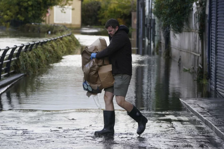
PARIS (AP) — Winds up to 180 kilometers per hour (108 mph) slammed France's Atlantic coast overnight as Storm Ciaran lashed countries around western Europe, uprooting trees, blowing out windows and leaving 1.2 million French households without electricity Thursday.
Heavy rain associated with the storm pushed ashore at the southwest tip of England, and the U.K.'s national weather forecaster warned of flood risks and urged people to take precautions. Dutch airline KLM scrapped all flights from the early afternoon until the end of the day, citing the high sustained wind speeds and powerful gusts expected in the Netherlands.
A weather-related death already was confirmed in France. A truck driver was killed when his vehicle was hit by a tree in northern France's inland Aisne region, Transport Minister Clement Beaune said.
Nearly all coastlines of the French mainland were under severe weather warnings Thursday morning, from Calais on the English Channel to all the way down the shores of the Atlantic Ocean to Spain, as well as much of France’s Mediterranean coast and Corsica, according to national weather service Météo-France.
The weather service reported record-breaking wind speeds of 108 mph (180 kilometers per hour) along the Brittany coast. The wind reached up to 96 mph (160 kph) on the Normandy coast and up to 90 mph (150 kph) inland. Waves of almost 33 feet (10 meters) were expected in the country’s northwestern tip.
Local trains were canceled across a swath of western France, and all roads in the Finistere region of Brittany were closed Thursday morning. Beaune urged people to avoid driving and to at least exercise caution when traveling across areas with weather warnings.
‘’We see how roads can be fatal in these circumstances,’’ he told broadcaster France-Info.
The storm cut power to some 1.2 million French households as of Thursday morning, electrical utility Enedis announced in a statement. That includes about half of the homes in Brittany, the Atlantic peninsula hardest hit by Ciaran. Enedis said it would deploy 3,000 workers to restore power as soon as weather conditions allowed.
The national train authority, the SNCF, canceled some regional trains in five eastern regions starting late Wednesday night. Fast trains from Paris were eliminating intermediary stops on route to Rennes and several other destinations.
In the U.K., southern England and the Channel Islands were expected to take the worst of the storm. Flooding was expected in 54 areas, according to the Environment Agency, most of them on England's southern coast.
Schools were closed in some coastal areas as a precaution. The U.K’s Met Office issued severe weather warnings for high waves and winds of about 80 miles per hour (130 kilometers per hour) or more.
“Trees are in leaf at the moment, so they are more top heavy,” said Rachel Ayers, a senior meteorologist at the Met Office, said as the storm approached Wednesday. “That does increase the risk of them falling over and also with the leaves around that makes (for) increased drainage issues.”
Authorities urged people in southern England to work from home, and train companies advised passengers not to travel on routes in and out of London before 9 a.m. Thursday as tracks were checked for fallen trees and debris, according to the Press Association news agency.
The blustery weather is the result of a branch of the jet stream — a consistent band of strong wind high above the Earth’s surface heading west to east — heading towards northern Europe, Henson said. The storm is caused by an interaction between what’s going on near the surface and a few miles above ground.
“It looks like a once-in-every-few-years storm for the U.K. and France,” said Bob Henson, a meteorologist and science writer with Yale Climate Connections, but Ciaran could turn into “a once in a generation storm.”
Friederike Otto of Imperial College London’s Grantham Institute for Climate Change and the Environment, studies the extent to which extreme weather events are caused by global warming.
She said there have been few studies on whether wind speeds were increasing because of climate change, and understanding is hampered by the fact that there were few observations of wind speeds taken far back in the past.
But the rainfall associated with such storms has increased due to human-induced climate change, she said That’s because a warmer atmosphere can hold more moisture which must fall as rain. On that, the science was “quite clear,” she said, with a 7% increase in rainfall for each degree Celsius (1.8 degrees Fahrenheit) of global warming.
Heavier rain leads to more damage, and rising sea levels due to global warming also lead to more damaging storm surges, she said.
___
Associated Press writer Elaine Ganley in Paris contributed to this report.
___
Follow AP's climate coverage at https://apnews.com/climate-and-environment

