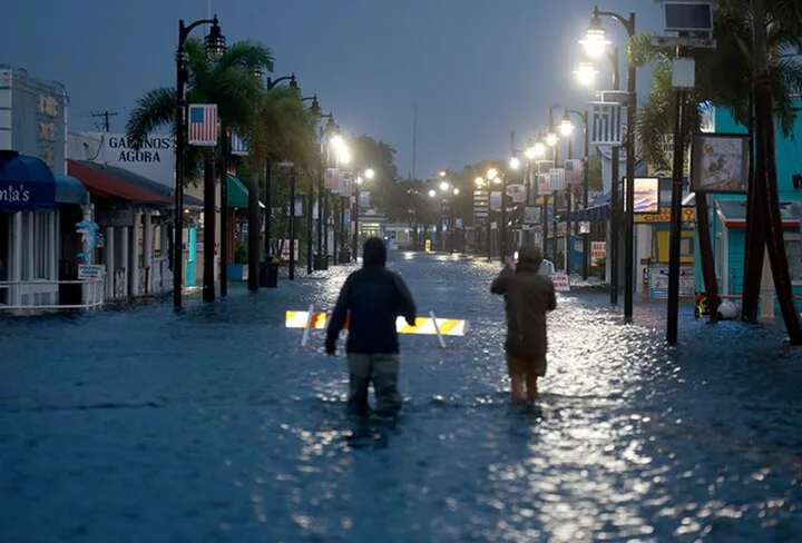
Hurricane Idalia came ashore on Florida’s west coast with destructive Category 3 winds, triggering blackouts and unleashing flooding rains and dangerous storm surge.
Idalia’s maximum sustained winds reached 125 miles (201 kilometers) per hour Wednesday as it slammed into the sparsely populated Big Bend region, the US National Hurricane Center said in an update at 7:45 a.m. Eastern time.
The hurricane was located about 55 miles north of Cedar Key as the storm crawls north-northeast. It’s expected to move along the coast of the Southeast US after crossing Florida.
“While Idalia should weaken after landfall, it is likely to still be a hurricane while moving across southern Georgia, and near the coast of Georgia or southern South Carolina late today,” the hurricane center said in an earlier update.
As much as 16 feet (4.9 meters) of sea water could be pushed onshore in some areas on the Gulf Coast, and 6 feet could slosh across Tampa Bay. The storm is struck north of heavily populated areas near Tampa and Clearwater.
Idalia will likely maintain hurricane winds further north into Georgia, which will increase power outages, said Anthony Chipriano, a meteorologist with Maxar. As of 7:15 a.m. local time, some 107,056 customers were without power in Florida, according to website Poweroutage.us.
Tampa International Airport was closed due to the storm. More than 500 flights in and out of Florida airports were canceled as of early Wednesday, according to data from FlightAware. Almost 100 were canceled to and from Atlanta, a major US transportation hub.
Idalia is the first major hurricane to hit Florida since last September. That’s when Hurricane Ian struck the western part of the state as a Category 4 storm, killing at least 150 people and causing more than $112 billion in damage.
The latest hurricane is likely a solid $10 billion storm in terms of damages and losses, according to Chuck Watson, at Enki Research. The storm is hitting sparsely populated area and that will keep damages down, but what is in its path – including people — will be in danger.
Parts of Florida, Georgia and the eastern Carolinas are likely to see as much as 8 inches (20.3 centimeters) of rain into Thursday, with up to a foot likely in some isolated areas, the National Hurricane Center said. Flash, urban and river flooding is likely, “with considerable impacts,” it added.
A tornado watch has also been issued for parts of Florida and Georgia through 3 p.m. local time Wednesday, the National Weather Service’s Tampa Bay office said on social media platform X.
“If you’re inside, just hunker down until it gets past you,” Florida Governor Ron DeSantis said at a Wednesday morning press conference. “You don’t want to mess around with these winds. There will be things flying all over the place.”
DeSantis extended an emergency declaration to cover 49 counties, with mandatory evacuation orders for several on the Gulf Coast. President Joe Biden approved federal emergency declarations for Florida, allowing the Department of Homeland Security and the Federal Emergency Management Agency to coordinate relief efforts. Georgia Governor Brian Kemp also declared an emergency Tuesday.
On its current track, Idalia is expected to miss most oil and natural gas platforms in the Gulf of Mexico. Still, Chevron Corp. was transporting non-essential personnel from its Blind Faith and Petronius platforms in the Gulf, the company said in emailed statement. Martin Midstream plans to temporarily cease operations at its Tampa oil terminal.
Most of the key citrus areas in central Florida shouldn’t be seriously impacted, World Weather Inc. President Drew Lerner said. Florida is the top orange-juice supplier in the US.
While some cotton crops could be damaged, along with fruits and vegetables, the main commodities of corn and soybeans should be fine, said Don Keeney, a meteorologist also with Maxar.
Author: Brian K. Sullivan

